The following content is archived, and is being kept for reference, research, or recordkeeping.
A STORY THOUSANDS OF YEARS IN THE MAKING
The poster for 2023 Archaeology and Historic Preservation Month tells the story of the last 13,000 years of the Great Salt Lake. This is the period of time when the lake’s changing size, shape, and salinity provided structure and constancy for human lives. Scroll down to capture a glimpse into the past through an examination of the artifacts and features created by the people who called the Great Salt Lake home.
ABOUT THE HEADLINE IMAGE
This photo was captured from a commercial plane as I was flying out of Salt Lake City. It is looking west, towards Antelope Island, with Stansbury Island in the background. As a hydrogeologist living in Salt Lake City, I have multiple personal and research connections to Great Salt Lake. It is a beautiful and important ecosystem that brings industry, recreation, ecology, and hydrology together. It is the terminus of much of the surface water and groundwater of the Great Basin. I have studied the springs, water chemistry, and geology all around the lake, including on Antelope Island. It is diverse, complex, and important. -Paul Inkenbrandt
The Great Salt Lake currently stretches about 75 miles north to south and 35 miles east to west. But when people first arrived at the end of the last Ice Age, the lake was much larger. Known as Lake Bonneville, the lake covered all of the West Desert from Nevada to Idaho, stretched as far south as Sevier, and covered Salt Lake City in up to 500 feet of water. Lake Bonneville eventually dried up as the climate became warmer after the Ice Age, and the lake shrunk to approximately the size and shape we know today. Around this time, lush, fertile marshes appeared at every river and stream inlet, and people began flocking to this inland sea.
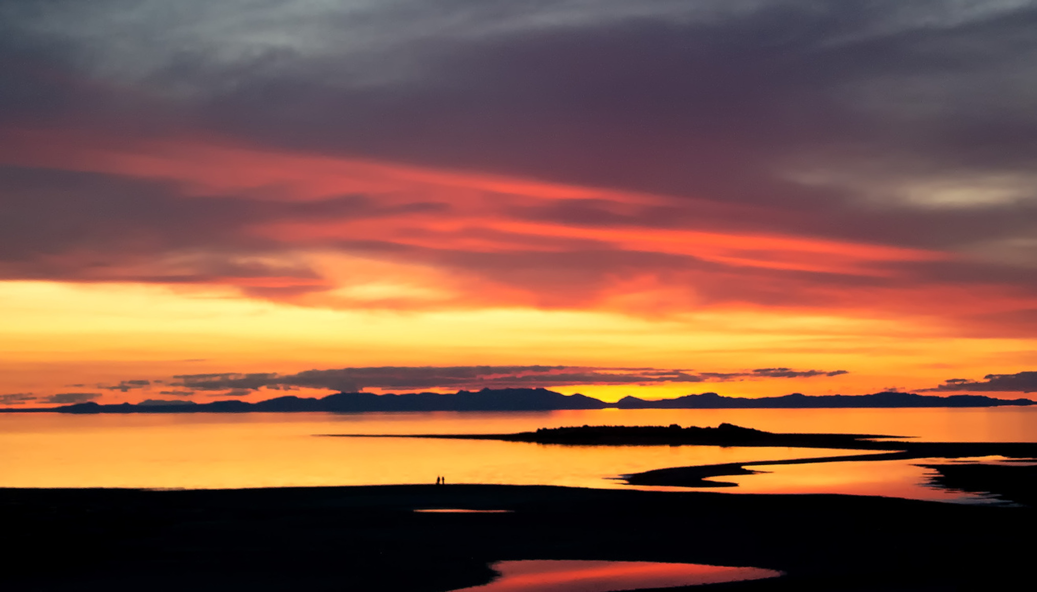
"The Blue Sunrise” This photo was actually a second thought. I had my large panorama camera set up and had just snapped a shot, so I decided to grab another with my digital camera that was slung around my neck. Timing, lighting and conditions were perfect. - Ron Winsett
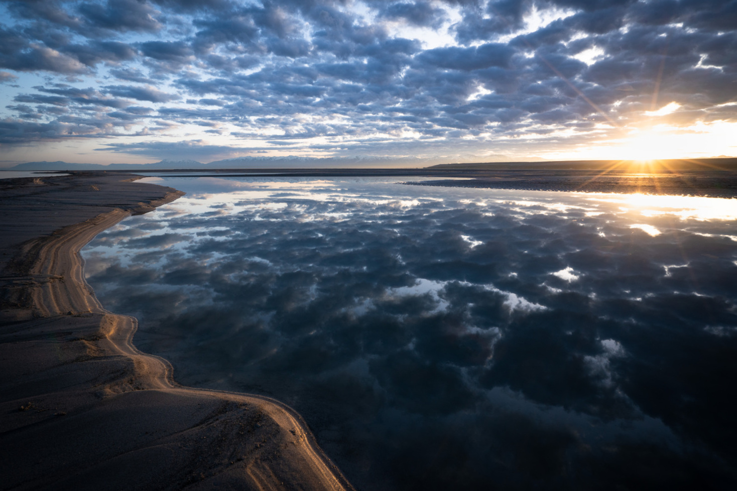
This photograph was taken on March 21, 2019 about the time serious concerns were being raised about the future of the Great Salt Lake. But I had my own problems. At that time, I had been undergoing treatment for a blood cancer for about four years. My doctors had told me part of their success in keeping me alive was that I had been active and was in relatively good shape when I was diagnosed. They also knew a return to an active lifestyle was one of the keys to a successful recovery (I already knew that, of course). For this trip, I had ridden my recumbent bicycle to Antelope Island from my home in Ogden, about 35 miles, and camped there. Even at the time I took the photo, I knew it was a great example of the significance of humans in their environment, totally a matter of perspective. I will continue to advocate for improvements in the quality of life through science and art. - Martin Neunzert
Much of what we know about the earliest people who called the Great Salt Lake home comes from shelters and caves. These places are dry, and sheltered from wind and weather that can scatter traces of human life. Archaeologists carefully excavate only small portions of these shelters, and use the natural strata to read the past like a book.
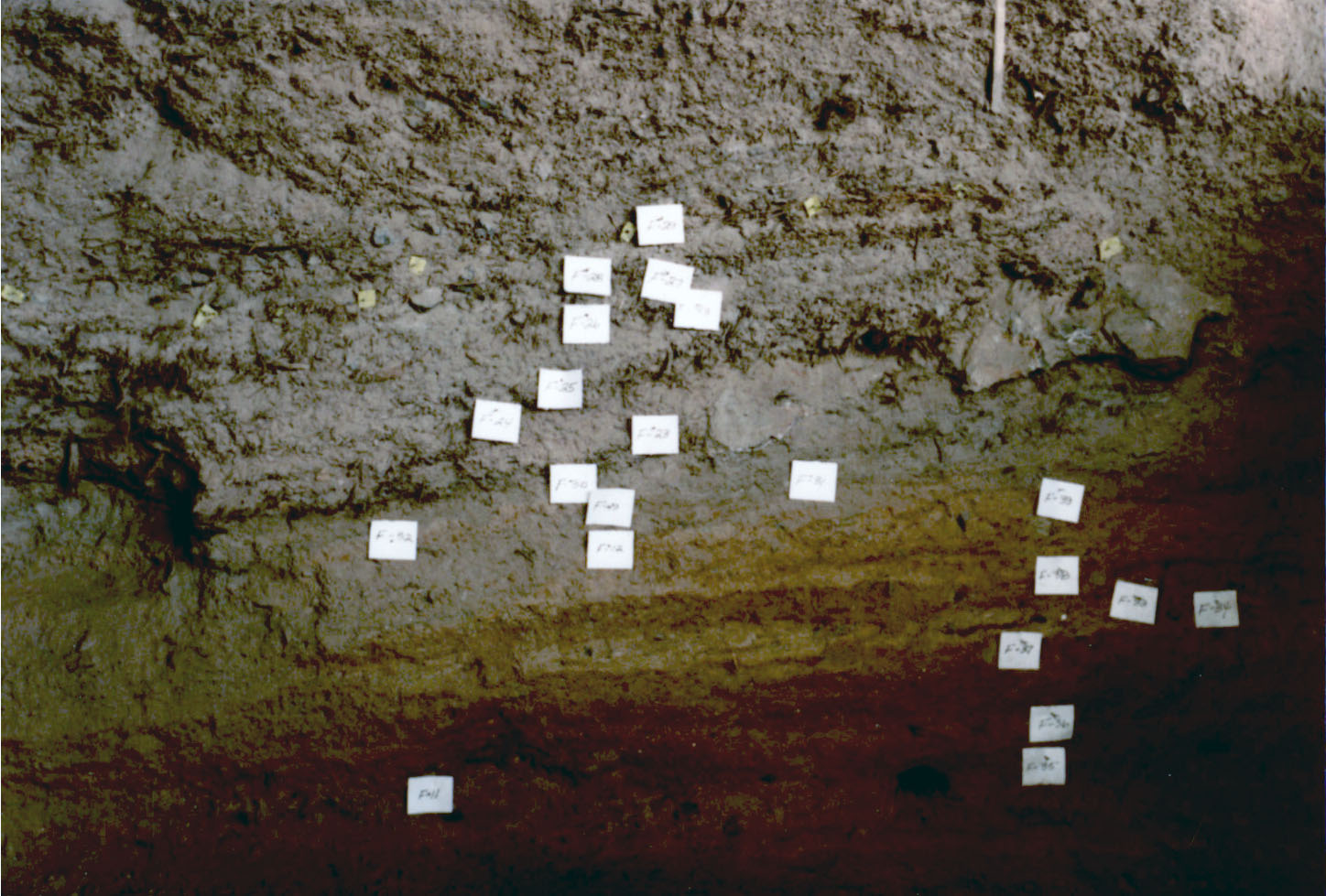
Stratigraphy from Lakeside Cave, Utah. Photo courtesy of the Natural History Museum of Utah.
These dry shelters are rare and of irreplaceable importance to understanding the past. Items that would degrade if left out in the open preserve for millennia in these dry, undisturbed places.
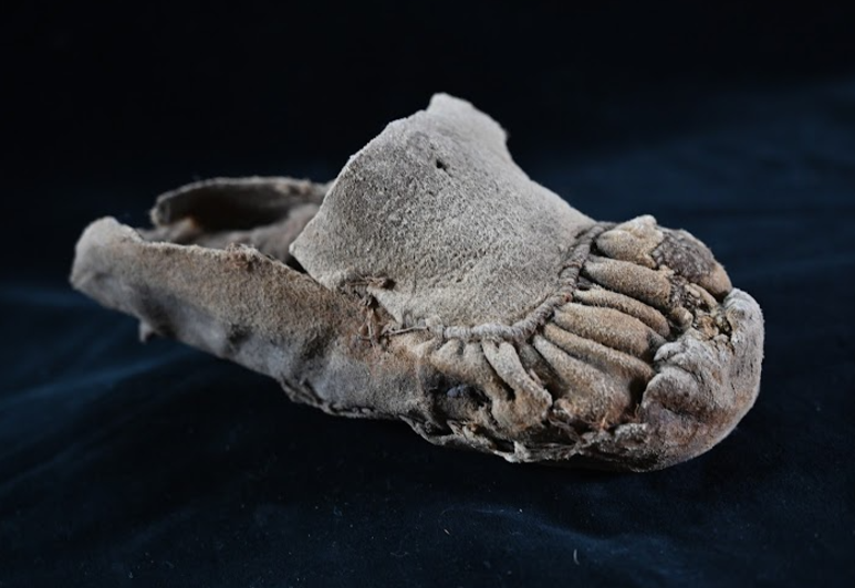
This is a child’s moccasin, found in one of the Promontory Caves on the north side of the Great Salt Lake. The style and construction of these moccasins kept the wearer warm with expert stitching, and would have been beautiful with their decorative quillwork. You can see some of these moccasins for yourself on the third level of the museum in Salt Lake City. Photo courtesy of the Natural History Museum of Utah.
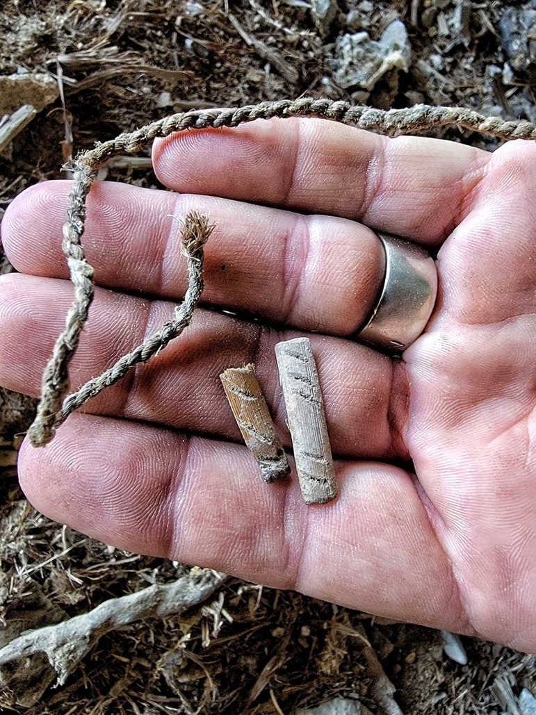
These are from caves around the lake. I was lucky enough to have a friend who knows the people who run the livestock on the privately owned farm. With a mixture of "Fremont Culture" and "Promontory Culture" — artifacts that were found within the cave systems, we were extremely lucky that the previous excavations did not remove all of the artifacts. Parts of tanned leather with cordage still attached could be found as well as the notched gaming pieces. - Mike Griffin
The Great Salt Lake hosted diverse ecosystems along its margins that people came to in order to fish, hunt, and obtain foods and medicines. The earliest people around the Great Salt Lake created baskets to carry seeds, berries, and other foods, sculpted grinding stones to prepare their meals, and chipped hard cherts and obsidian into points to hunt, deflesh, and cut their meat. The design of these tools were so functional that people today still use them, thousands of years later.
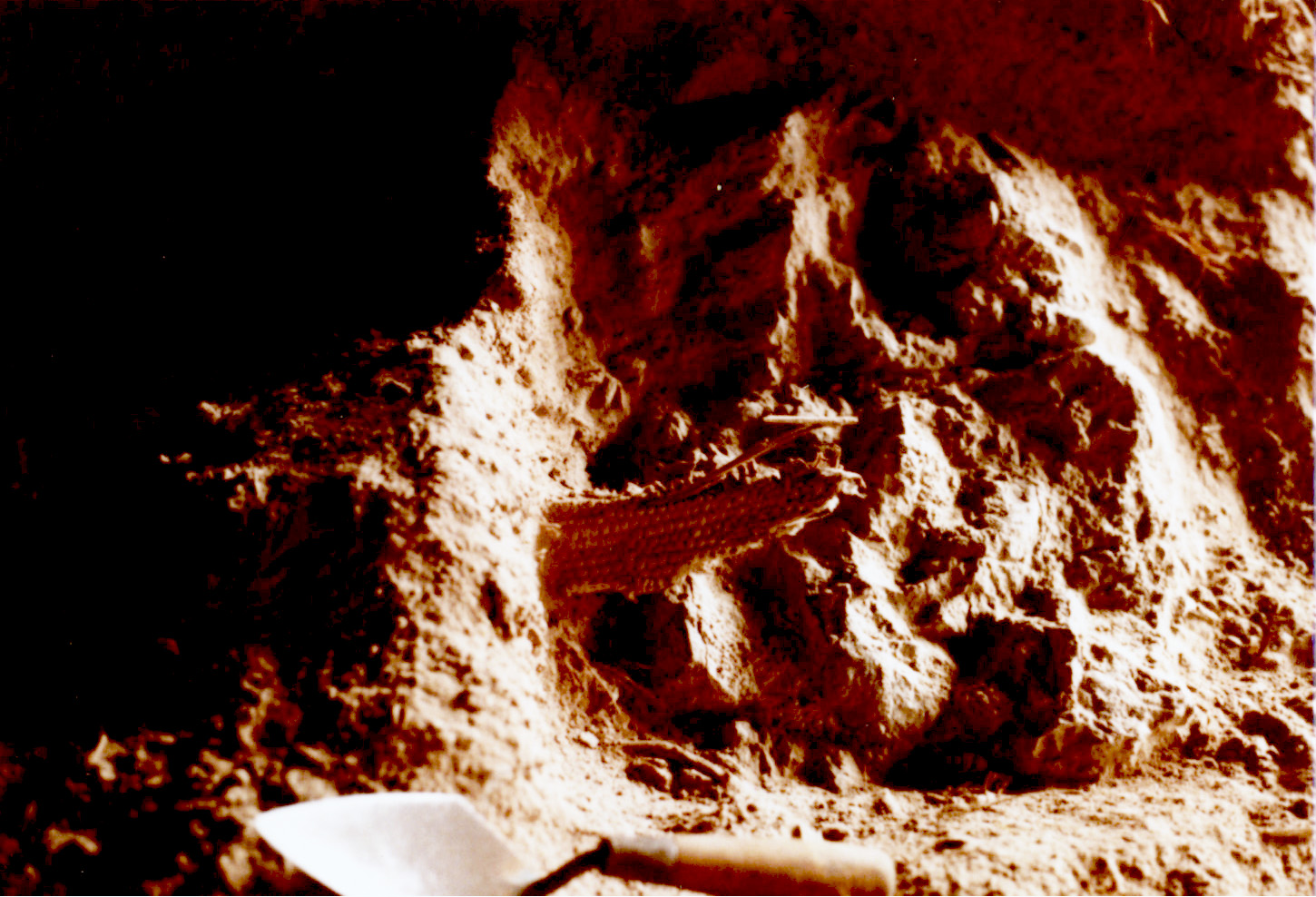
This is a piece of ancient basketry being excavated out of a dry cave around the Great Salt Lake. As long ago as 6,000 BC, basket weavers were distinguishing themselves from one another by the methods, materials, and designs they used to create their pieces. Photo courtesy of the Natural History Museum of Utah.
Video: Dr. Jim Allison of Brigham Young University shows us dart points from around the Great Salt Lake.
.
Video: Dr. Jim Allison of Brigham Young University shows us groundstone from around the Great Salt Lake.
The Great Salt Lake was a gathering place for people throughout the ages. From villages to campsites and from hunting grounds to rock writing sites, people came together along the shores of the lake for a multitude of reasons.
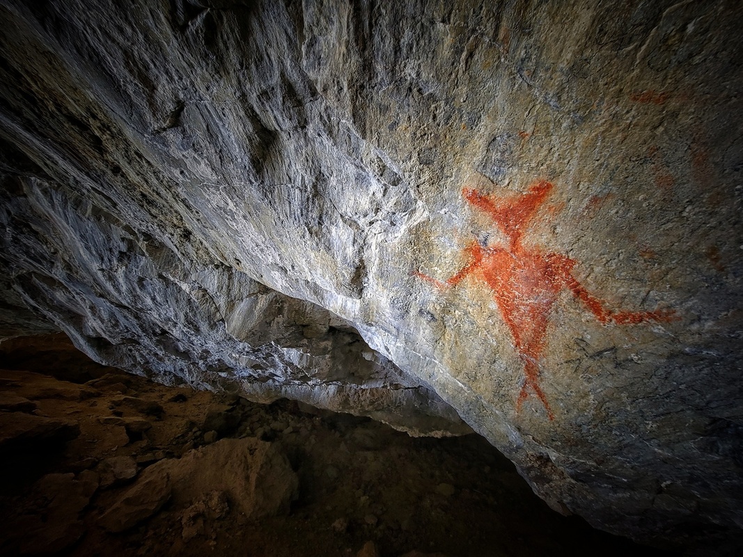
This is a large Fremont-style pictograph within the cave’s walls, and the most visible. Being in the caves was quite the experience for me, knowing the history and the information the artifacts provided. Not sure what their thoughts were when they were living there, but today looking out from the caves is quite the astonishing view! - Mike Griffin
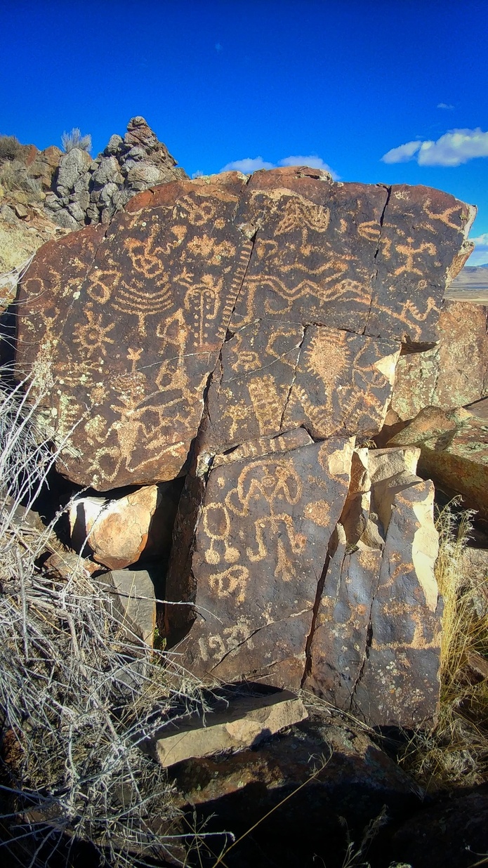
I took this photo about 6 years ago out at the ATK property at Connor Springs. From everything I've read and been told, it has been an area of continuous use. On this rock you can see Great Basin Abstract and Representational designs from the Archaic Period, and Fremont-style pictographs are nearby. The Shoshone were known for also using the lands and natural hot springs at the GSL shores for the medicinal baths. All of these aread are pretty barren now with invasive weeds like Russian thistle and cheatgrass growing everywhere. But it’s pretty neat to imagine how it could've looked with more thriving springs, which have now almost all dried up. - Mike Griffin
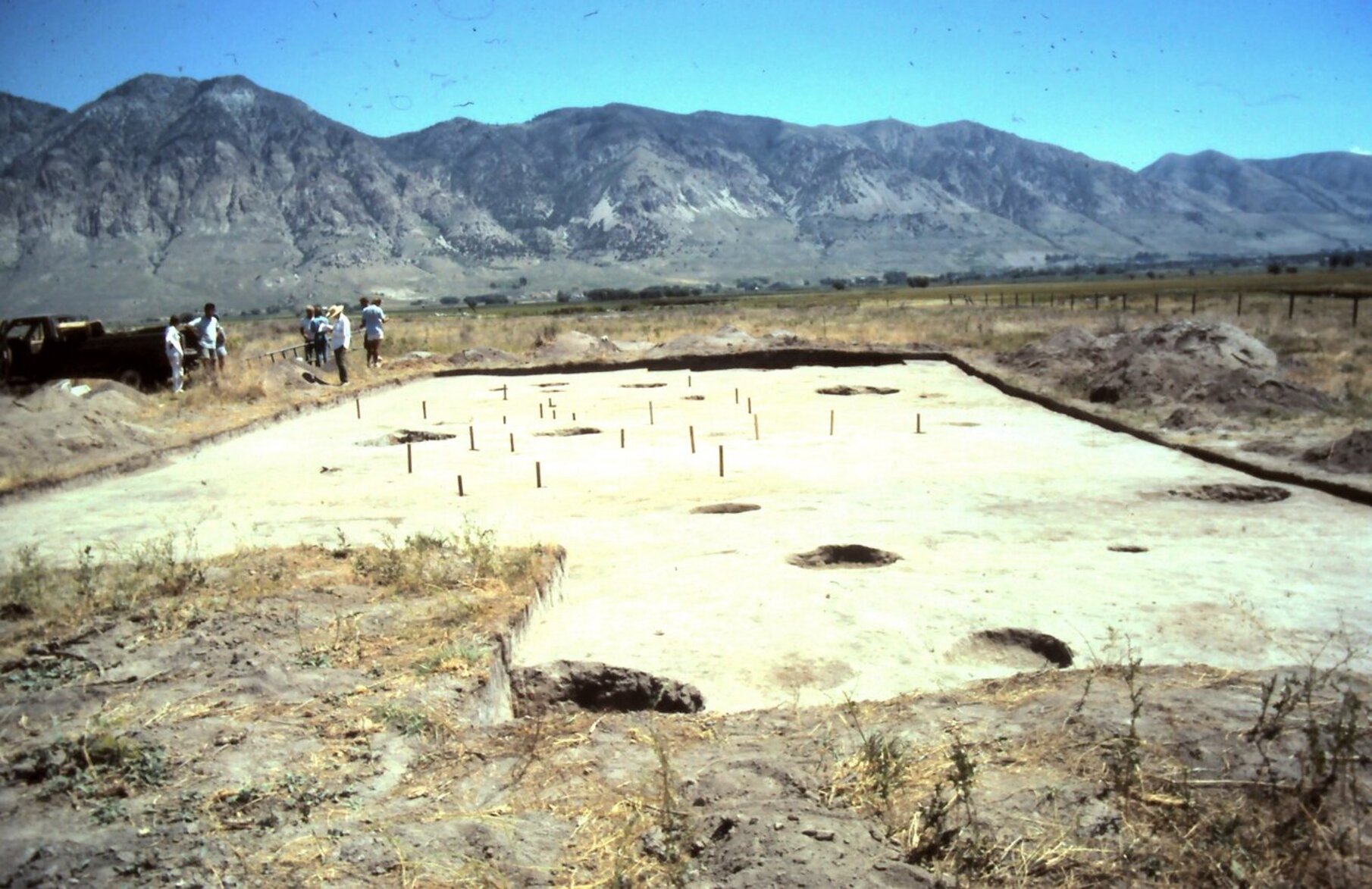
Villages and campsites sprang up near reliable freshwater sources, predictable game trails, and seasonal plant patches. Especially in the Fremont Period, people settled along the shores of the lake in small communities. Archaeologists have found some of these villages that were occupied and re-occupied for centuries. The people who lived along the Great Salt Lake brought goods with them from far and wide, like toolstone and beads.
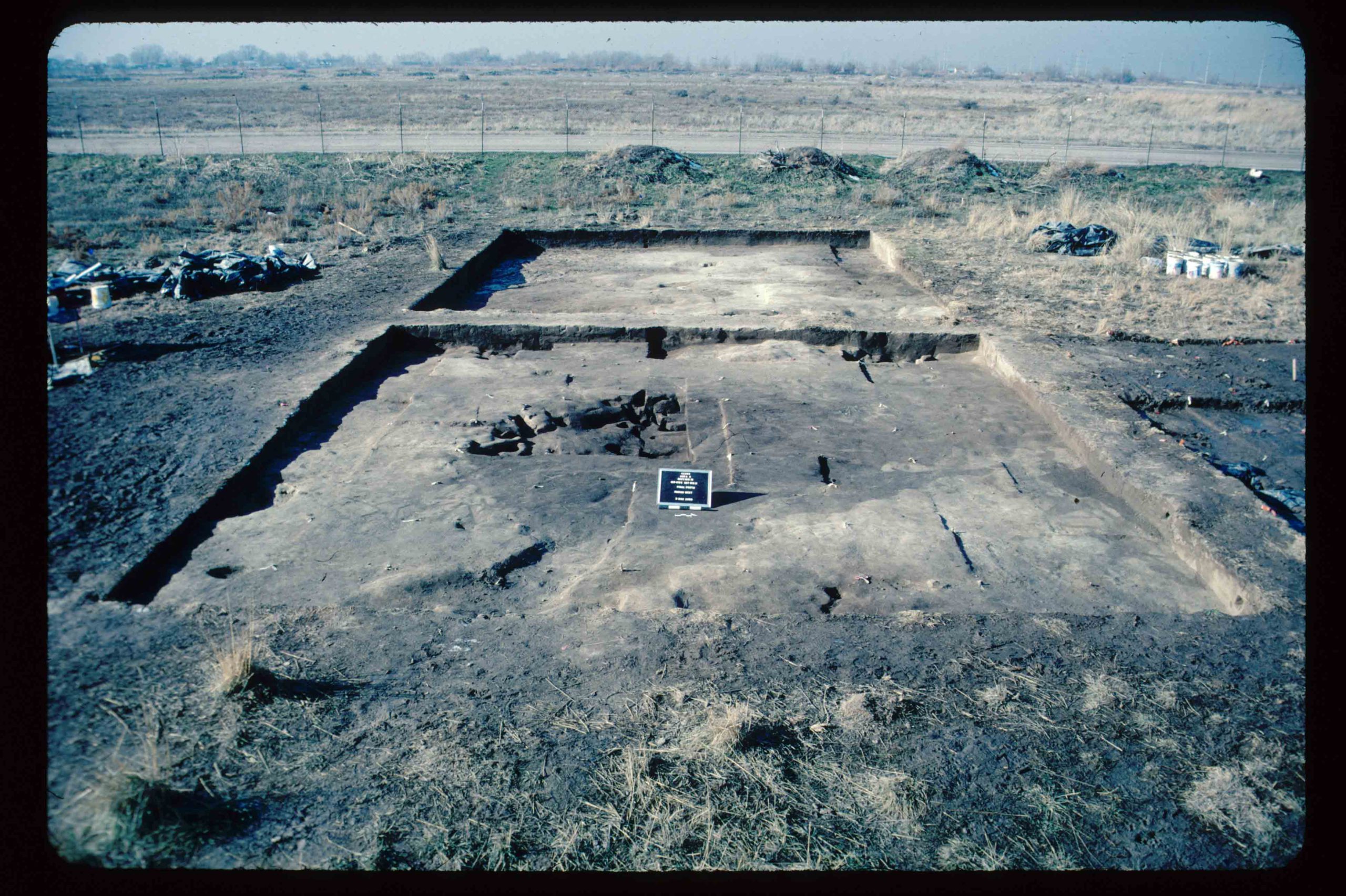
Can you see the Archaic Period home in this photo? Near the center of the excavation block there is a shallow depression with postholes and a hearth. This is what remains of someone's house from thousands of years ago. Photo courtesy of Dr. Jim Allison, Brigham Young University.
Final overview shot of the Orbit Inn Excavation with stakes outline habitation structure and showing the subsurface pits and midden arching around top of structure. This photo was taken in 1982. - Mark Stuart.
Video: Dr. Jim Allison of Brigham Young University shows us jewelry from around the Great Salt Lake.
Video: Dr. Jim Allison of Brigham Young University shows us an abrader from around the Great Salt Lake.
Video: Dr. Jim Allison of Brigham Young University shows us a knife from around the Great Salt Lake.
The influence of the Great Salt Lake persisted from the earliest humans into more recent history. The Shoshone people hunted along the shores of the Great Salt Lake for centuries, and today many Shoshone people still call the cities and towns near thelLake their home. As Euro-Americans moved into the valley, they created cultural touchpoints around the lake as well.
“Where’s the Lake” taken from the old Saltair site. I remembered years ago you couldn’t even walk where I took that photo because it was under water. Now the shoreline is 1.5 miles away. - Ron Winsett
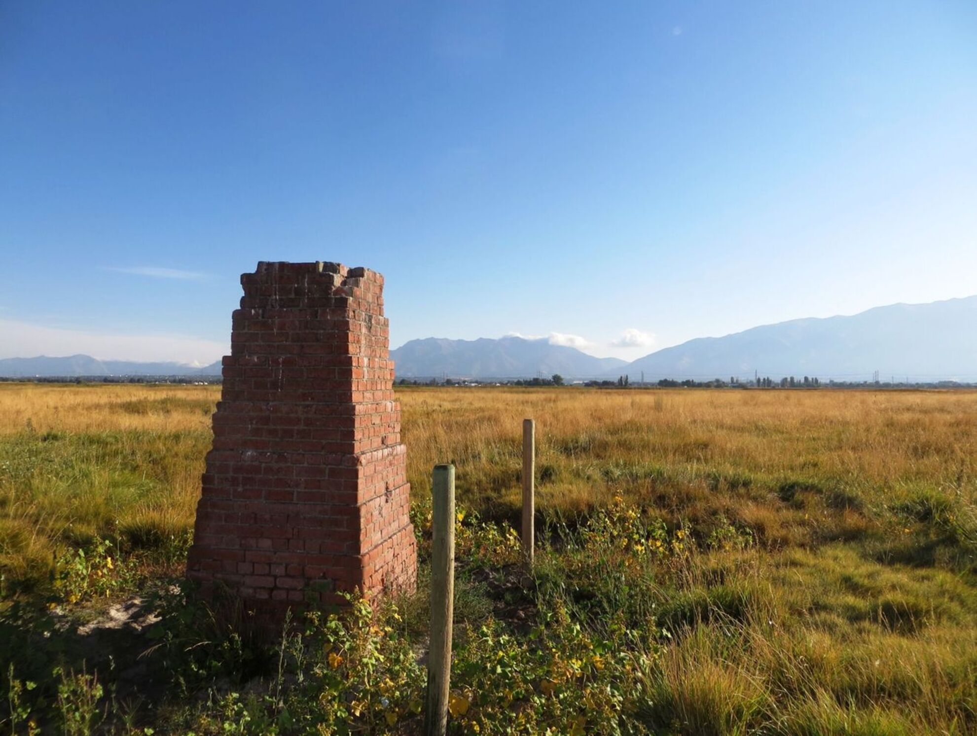
This is one of two Salt Lake South East and North West Base Monuments still standing in the Layton, Davis County area. They are brick survey monuments (the other is 11 kilometers to the northwest) built in 1896 for the Salt Lake Base as part of the Nevada Net developed during the Great Triangulation in the Great Salt Lake region. They acted as line of sight monuments in order to survey this important baseline and also to demonstrate the efficacy of the Duplex Base Apparatus. Although there were altogether ten baselines like this one used during the Great Triangulation across the United States, no other monuments such as these two were built. Photo courtesy of Greg Seymour.
Video: Dr. Jim Allison of Brigham Young University shows us several arrowheads from around the Great Salt Lake.
The Great Salt Lake has been a constant companion for humans for hundreds of generations. It greeted the earliest explorers on the continent 13,000 years ago, and it still draws people to visit. This year for Archaeology and Historic Preservation Month, we’re honoring the lake for its support of people and communities through the ages.
The Utah SHPO wants to extend a special thank you to the contributors for this year's poster and this article. Your generosity is what made this possible.
