Deb Miller, Records Manager, SHPO

If you have visited Park City to ski, participate in the epic-ness of the Sundance Film Festival, or even just escaped the heat of the valleys for some mountain coolness, you might have noticed an unassuming pocket park below City Hall. Much of Park City’s mining history in the urban downtown has made way for new developments, expanded houses, or even rebuilt after a devastating fire. But occasionally there is a piece, or perhaps wall, of this mining history that can be found if you look hard enough.
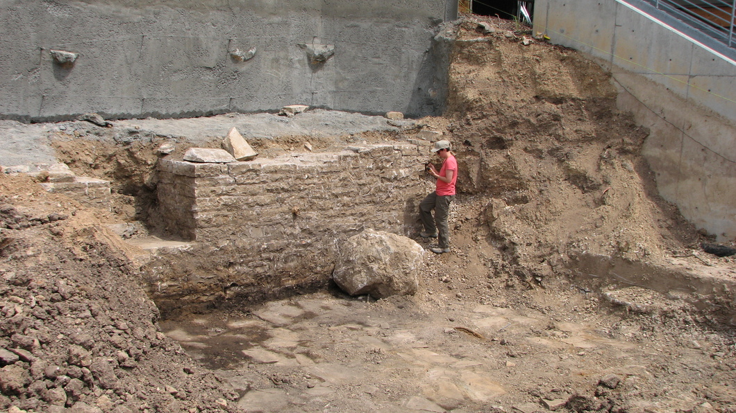
During the construction of the State Liquor Store in the early 2000s along Swede Alley (east of Main Street), crews encountered a rock wall associated with a mine building. Reburying the wall at the time, the intention was to excavate it out in 2013 and turn it into a historic pocket park. Unknown to the crews, there was not just the wall but also an intact flagstone floor and artifacts. Upon this discovery Park City’s Historic Preservation Planner, Anya Grahn, reached out to the Utah State Historic Preservation Office for technical assistance. As there was no legal connection to the undertaking from a state or federal perspective, myself and Chris Merritt documented the building foundation and associated artifacts.
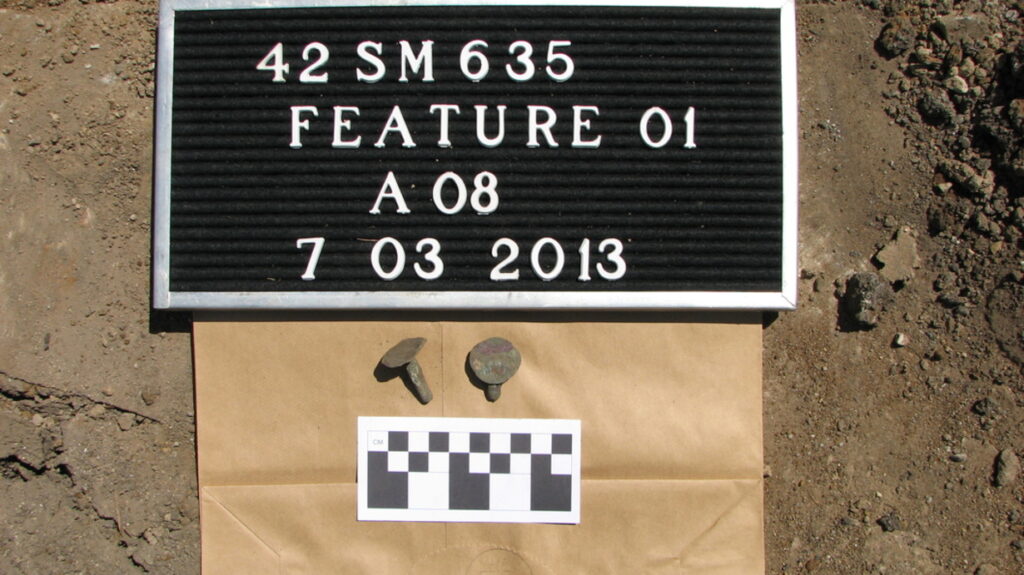
On July 3, 2013 we documented the foundation and completed a detailed site map of the feature and identified the artifacts. Artifacts included several different alcohol bottles including a bottle base with “R&CO” which refers to the Reed & Company of Massillon, Ohio, and made between 1881 and 1904, while a second bottle dates to 1903-1929. There were also fragments of a brown-glazed porcelain insulator, copper rivets, a lead pipe, and some bird bones. It is possible that the bottles and other artifacts fell into the foundation as it was demolished and buried originally or in the early 2000s.
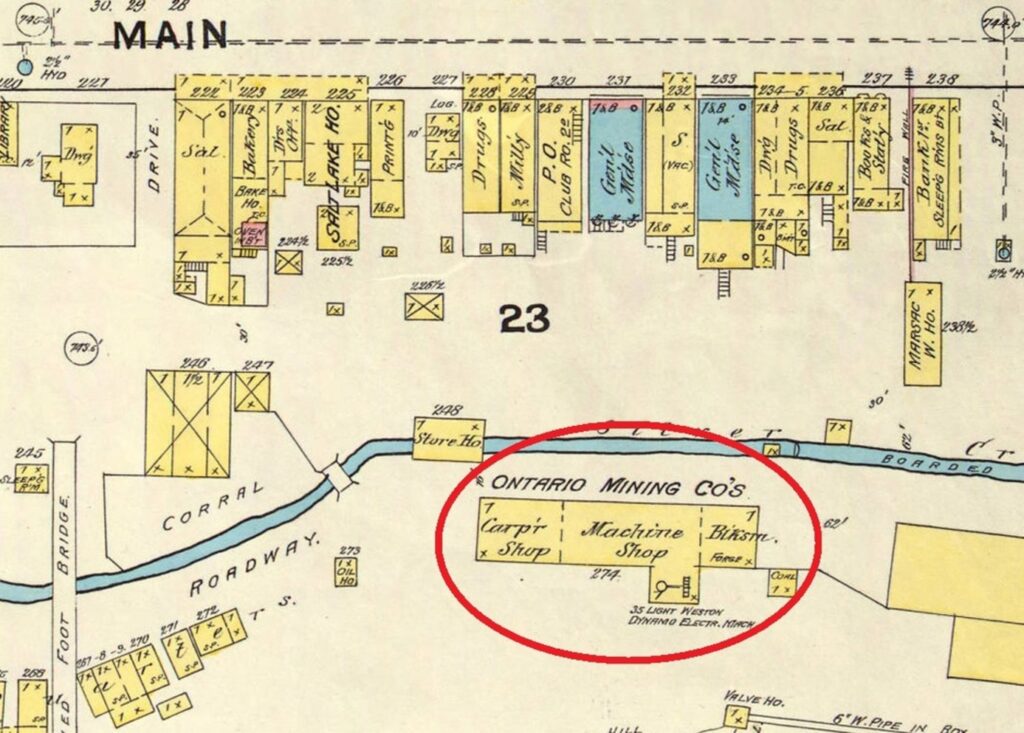
With some historic research, including copious use of the Sanborn Fire Insurance Map collection at the University of Utah. Through this research, we were able to overlay an 1889 Sanborn image of Park City on top of modern aerial imagery to formally determine that the foundation was that of the Ontario Mining Company’s building that included a Carpenter, Machine, and Blacksmith Shops within a stone and wood frame structure. The original foundation would have measured approximately 150′ long by 50-75′ wide, and this portion is only about 8-10% of the total, and just the northeast corner of the Blacksmith Shop. The Ontario Mining Company was one of the largest and most successful mining ventures in Park City.

After a glorious sun-filled day out of the office we finished our work, and Park City continued with their construction. Today, if you swing by the pocket park you can still touch a piece of history and Park City and their contractor did an amazing job of finding a great use for an old piece of the town’s mining history.